Municipality of Sarangani, Davao Occidental: The Hidden Gem of the South
 |
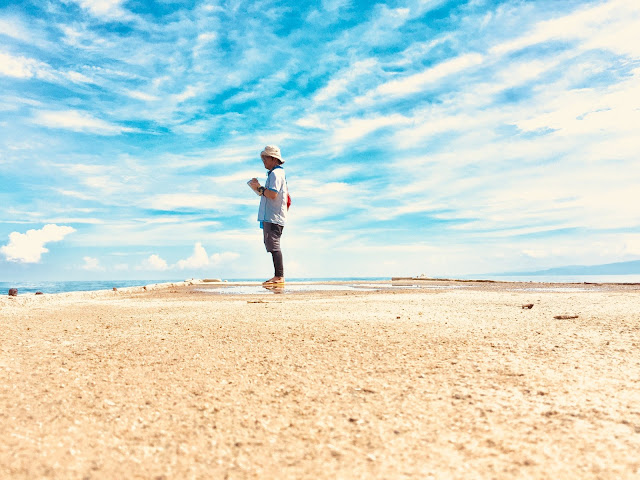
| Balut Island at dusk. |
The island Municipality of Sarangani is the southernmost municipality of the Province of Davao Occidental and of Davao Region. It is situated along the Philippines-Indonesian Border. It is bounded to the north by the Saranggani Strait along the Saranggani Peninsula, to the east by the Philippine Sea, to the west by the Celebes Sea, and to the south by the Moluccas Sea. These seas are unique from each other because of its different bathymetry, geologic setting, and wave directions driven by opposing trade winds. This makes the place secluded and often inaccessible. The municipality is often called "Balut" because "Balut Island" is where the municipal center sits. It is just one of the two major islands of the municipality together with its adjacent Saranggani Island. Based on old satellite images, there are 3 additional islets namely; Olanivan, Manamil, and Marorong. But because of coastal erosion brought by large waves, few sea cliffs are starting to break and divide forming sea stacks or stumps. There are only few people living on the two islands while the islets are left uninhabited. These people are mostly from the B'laan tribe of Southern Mindanao and Sangil tribe of Indonesian descent. Despite the cultural diversity, people live in harmony. Most of them are either farmers cultivating the upland or fishermen enjoying the bounty of the surrounding seas. For long, the natives rely on these as source of income. Only few tourists brave to visit the islands because they were misinformed that the islands are inhabited by pirates and that they were afraid of the large waves. Based on our experience, it is a hoax that there are still pirates on the islands in fact locals are so hospitable. The second statement is somehow half real. Yes, waves are larger during extreme weather conditions as it is affected by the monsoon or trade winds. However, there is less chance that the area will be affected by typhoons. For this, proper timing is the best solution. Our pump-boat operator even joked on us that the island is often called "Balud Island" which translates "Wave Island" in english.
Since tourism is often connected to geology, I will be giving you a short background of the geology of the area. Balut Island is the northernmost extension of the Sangihe Volcanic Arc composed of chain of volcanoes extending from the seafloor towards the surface. Hence, some of these small islands along the Moluccas Sea are just the volcanoes' tip. These volcanoes are of Quaternary age formed by the subduction of Moluccas Sea Plate at Sangihe Trench towards the Celebes Sea margin. PHIVOLCS classified Balut as a potentially active volcano just like Mt. Apo wherein there are no recorded volcanic eruptions during the recent age but there are signs of volcanic activities indicated by the presence of fumaroles, solfataras, and hot springs. On the other hand, Saranggani Island which is just few kilometers east of Balut is an uplifted landmass mostly composed of marine deposits such as limestone and sandstone. This might be associated to active tectonism within the region. Because of these, the two islands differ from each other in terms of its geologic formations and tourist attractions.
How To Get There:
Although it is part of Davao Region, most of the commercial ferries plying to and from Balut Island comes from General Santos City which is the nearest city to the island. For those coming from Manila, there are direct flights to and from General Santos City served by Philippine Airlines and Cebu Pacific Airlines. To those from Davao City like us, it takes around 3 hours of travel to get to General Santos City via the Maharlika Highway. From the port of General Santos, it takes around 8 hours of travel by ferries to get to Mabila port of Balut Island. Do not worry, you will not get bored on the trip as it travels at night and these ferries have beds on board for you to just sleep and wake up in the morning arriving at Balut. During my first visit with my workmates, we took this route. But on my second visit, we took the alternative route. We rented a pump-boat from Brgy. Balangonan which is the southernmost barangay of Jose Abad Santos at the tip of Saranggani Peninsula. It just took us an hour and a half crossing the Saranggani Strait to reach Mabila port. But this route is not recommended especially during monsoons because waves from different directions meet at this point. We also stayed there from September 19-27, 2017 which was I think during the southwest monsoon or "Habagat" so we already expected some big waves.
Things to Do:
Since we were there to conduct fieldwork, we never enjoyed the islands! Joke!..hehehe..It is somehow the perks of our job that we are paid to travel 😊. Our work involved geologic hazards assessment hence we are able to explore almost all the sides of the municipality. Since most of the settlements are along the coastal areas and there are only few roads within the islands wherein most of it are rugged, we rented a pump-boat for the whole duration of our stay. So here are the things you can do during your stay;
1. Island hopping. As what I've mentioned, every island is unique. For example, Balut has black, white, and gray sand pocket beaches in between its resistant headlands. Manamil Islet with an abandoned lighthouse on top is a small sea stump along south separated from Balut because of wave erosion. Just in front of Mabila port is the Marorong Islet which was utilized as a private resort. The beautiful wide white sand beaches, sea cliffs, sea arches, sea caves, and pristine coves are Saranggani Island's features. North of Saranggani Island is the egg-shaped Olanivan Islet famous for its fine, white, and sugar-like sand beach. It is often compared to the then undeveloped island of Boracay.
2. Diving and snorkeling. Saranggani Island still have preserved their coral reefs and their local tourism office identified some diving spots. During fair weather conditions, local divers visit the Bolay Cove because of its lush marine biodiversity. Tourists could also do snorkeling at the Tuke Nonsol Sea Arches. As of the moment, the tourism office still explores for more diving sites.
3. Feel the warm welcome of hot springs. Balut Island's hotsprings are mostly along the coastal areas. However, most of these are too hot that it isn't safe to bath just like the abandoned resort in Sitio Sabang of Brgy. Lipol. During our survey, we discovered a hot spring on a tidal flat at Brgy. Tagen.
4. Climb the peak of Mt. Balut. The jump-off point and hiking trail is at Brgy. Gomtago. Log-in at their barangay hall where they will offer a local guide towards the peak. Some of my team members went to the peak where they've seen the neighboring islands.
5. Eat fresh seafoods. Fishes, crabs, shrimps, and lobsters here are way cheaper. If you are on a budget trip, you can just go to their public market or even local ports. You can also contact some local fishpond operators. During our first visit way back 2013, our driver bought a king crab for only 100 PhP. They didn't even weight it but I think it weights a kilo..I'm not sure 😊.
Areas of interest:
1. Mt. Balut Peak
2. Sabang Hotspring
3. Olanivan Islet
4. Tuke Maklang
5. Tuke Nonsol and Camalig Sea Caves
6. Bolay Cove
7. Patuco Cove
8. Laker White Sand Beach
9. Manamil Islet
10. Marorong Islet
 |
| Tuke Nonsol is a sea arch formed by wave action on a limestone cliff in Sarangani Island |
 |
| Saranggani Island at dusk. |
 |
| Fine white sand of Olanivan Island. |
 |
| Bolay Cove in Brgy. Camahual |
 |
| Camalig Sea Caves |
 |
| This tidal inlet is the mouth of Patuco Cove |
 |
| Laker White Sand Beach |
 |
| Sabang hot spring at Brgy. Lipol |
I would like to thank the Local Government Unit of the Municipality of Sarangani especially to Mayor Virginia Cawa and the MDRRMO led by Sir Graybert for providing us comfort during our stay. We felt safe and at home 😉. To our pump-boat operator Kuya Boyeng and his crew, thank you for bravely touring us around the islands despite the bad weather especially that ride back to Balangonan..hehehe. Naligo man unta mi pero basa gihapon mi sa kadako sa balud..hahaha. To the nursery caretakers, thank you for the delicious daily meal. To our local guides, thank you for bringing us to the camp safely..salamat wa jd mi ninyo gisaag..hehe. To all the people of Sarangani, thank you for the warm welcome and support despite our strange daily get-ups (field attires)..hehe
Sending you some SARANG...GANI💖! from Team Lame Siyang Bayhana!

 |
| Olanivan Islet |
Comments
Post a Comment